The Pakistan Regional Maps: Precipitation and Temperature Extremes page delivers up-to-date insights on weather across the country. Updated at daily or 12-hourly intervals, these maps showcase areas experiencing significant rainfall and temperature anomalies. Using data primarily from the GFS model and NAM for Pakistan at 12-hourly intervals, the maps are refreshed twice daily after the 00Z and 12Z model runs. This resource is essential for tracking climate impacts and guiding effective responses.
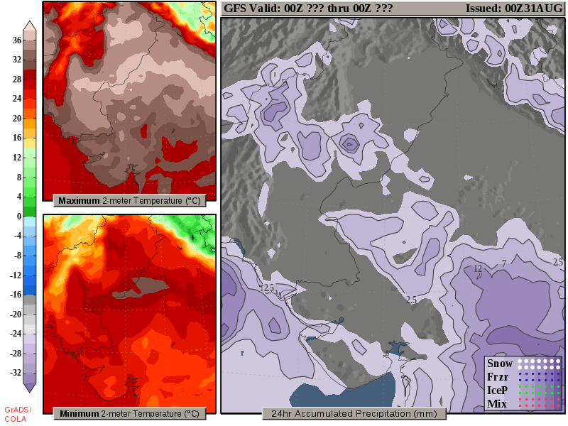
24-Hour Rainfall and Temperature Extremes

The image provides short-term regional forecasts for Pakistan, highlighting accumulated precipitation and daily maximum and minimum temperatures at 2 meters. It shows 24-hour rainfall in mm, along with daily temperature extremes, giving you a clear view of upcoming weather conditions.
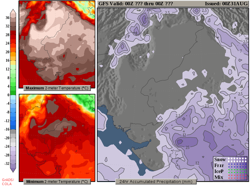
Upcoming Day 2 Weather for Pakistan: Rainfall and Temperature Extremes

The image provides a short-term forecast for Pakistan, focusing on day 2 (the next day). It includes 24-hour accumulated precipitation in mm and the daily maximum and minimum temperatures at 2 meters, offering a clear snapshot of the expected weather conditions.
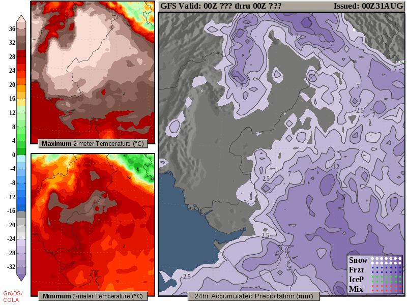
Day 3 Outlook for Pakistan: Detailed Rainfall and Temperature Forecast

The image provides a regional short-term forecast for Pakistan, focusing on the weather for the third day ahead. It includes 24-hour accumulated precipitation in mm and the daily maximum and minimum temperatures at 2 meters, offering a clear view of the expected conditions for day three.
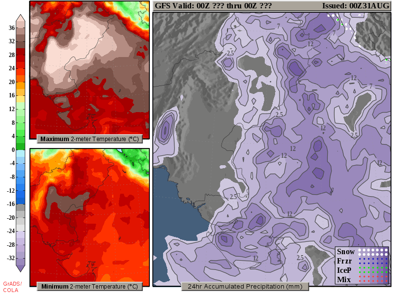
Pakistan Short-Term Forecast: Day 4 Rainfall and Temperature Overview

The image offers a regional short-term forecast for Pakistan, focusing on day 4. It displays 24-hour accumulated precipitation in mm along with the daily maximum and minimum temperatures at 2 meters, providing a clear view of the expected weather conditions for the fourth day.
